


Live Earth Map-Gps Satellite
3.01.00 Reviews
App Specs
- Version
- 1.17
- Updated On
- License
- Free
- Downloads
- 100,000+
- Developer
- Game Soft Studio 3D
- Categories
- Maps & Navigation
- Platform
- Android
Screenshots
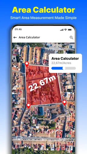
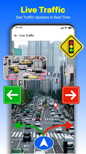
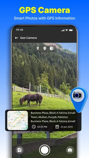
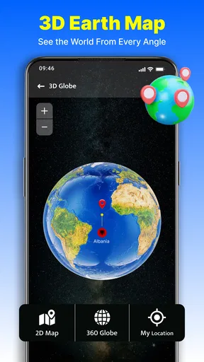
 Analysis by AppCompare
When I need to get somewhere unfamiliar, my first question is usually practical: can I understand the area before I set off, and can I still orient myself once I am on the move? Live Earth Map-Gps Satellite puts map viewing, satellite imagery, GPS camera tools and route navigation in one Maps & Navigation app. That mix makes it appealing for a quick look around as well as trip planning, though I would treat it as a companion to a dependable navigation option rather than assume every part of a journey will go smoothly.
Choosing the right starting point
The app is free to install and is made by Game Soft Studio 3D. It is rated for Everyone, has reached over 100,000 installs, and currently sits at an average of 3.0 from 53 ratings, so I would go in with measured expectations rather than assume it will suit every phone or travel habit. Its current version is 1.17, and it requires Android 7.0 or later. There are in-app purchases priced from $7.99 to $29.99 per item, which is worth keeping in mind if you are comparing it with free map tools.
Before relying on any navigation app for an important trip, I like to try it at home. Search for a familiar destination, move around the map, and see whether the controls feel clear on your screen. Then check a place you do not know well. This small test helps answer a useful question early: is the app comfortable for the way you explore, or do you prefer the simpler presentation of a conventional turn-by-turn navigator?
From looking up a place to reaching it
I find it useful to think of the trip as a sequence: first build a picture of the destination, then choose which view answers the next question, and only then set off. That approach makes it easier to spot when exploration is helping and when I should hand the job back to a simpler navigator.
Explore first, then plan the trip
When I first downloaded Live Earth Map-Gps Satellite, I was a tad skeptical. I mean, can an app really bring the world's most amazing places to my screen with just a few taps? But as soon as I opened it, I was hooked. The interface is super intuitive. You don’t need to be a tech wizard to navigate through the features. It's like the app just gets you and knows you want to dive straight into exploring.
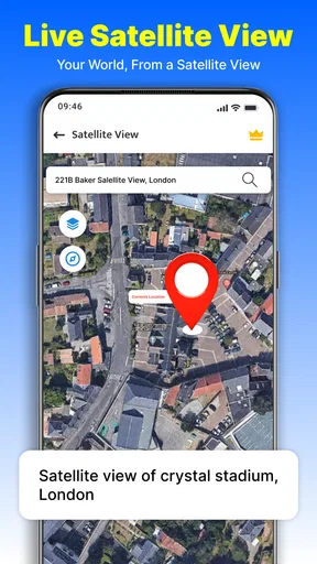
The app starts with a simple world map. You can zoom in and out with a pinch, swipe around to explore different regions, and tap to discover more about specific locations. It's as easy as pie! And the best part? The satellite images are stunningly clear, making you feel like you’re actually flying over these places.
That kind of view is most useful before you commit to a route. For example, if I am meeting a friend at an unfamiliar park, I can first inspect the surrounding streets and look for the entrance that makes the most sense. The overhead perspective can make the layout easier to understand than a list of turns alone. I would still confirm the destination address and plan a sensible approach; a map view can help me recognize an area, but it cannot replace checking the details that matter for an appointment.
Worth Reading Before You Choose

EA SPORTS FC Mobile 26 Is a Bigger Football Game, but It Takes Time

Flipboard Shows What News Apps Must Do Beyond the Feed

Switching to Android Auto Means Rethinking Your Driving Routine

Google Calendar Makes a Crowded Week Easier to Manage

Ludo King Makes the Most of the Minutes Between Plans

Baby Panda World Brings Quick Play to Modern Phones, but Its Game Library Feels Busy
Use street-level views with a purpose
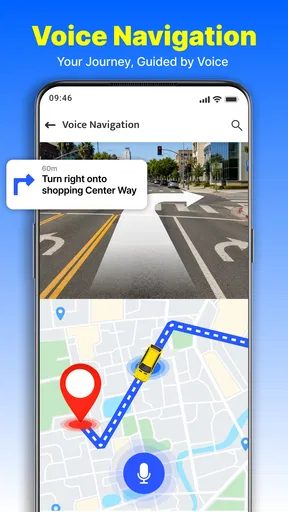
So, what exactly can you do with this app? For starters, Live Earth Map-Gps Satellite offers real-time GPS navigation. Whether you’re planning a road trip or just curious about the traffic in New York City, the app’s got your back. It provides you with live traffic updates, which is a total game-changer if you ask me.
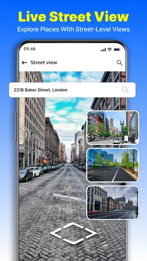
Another cool feature is the 3D street view. Ever wondered what it’s like to stroll down the Champs-Élysées? Just tap into the street view, and voilà! You’re there, virtually walking down the street. It’s not just a flat image; it’s immersive and makes you feel like you’re part of the action.
I find street-level browsing most valuable as a recognition tool rather than a substitute for being there. Before visiting a café or a building with several nearby roads, looking at the street can help me notice the general appearance of the block and feel less disoriented on arrival. It is also a pleasant way to explore a destination when I am not travelling. I would not assume that a virtual view tells me what conditions look like right now, though: imagery and live conditions are different things, and I would use current signs or local guidance for decisions on the ground.
Keep the handoffs simple
Oh, and let’s not forget the weather updates. Planning a trip to the beach? Check the live weather forecast directly in the app. It’s like having your personal weather station, ensuring your plans go off without a hitch.
One thing that really makes this app stand out is the attention to detail. The satellite imagery is incredibly detailed, allowing you to zoom in on landmarks and get a real sense of place. You can even spot tiny cars on highways or boats in harbors – it’s that precise!
The app also offers a location-sharing feature, which is perfect for keeping friends and family in the loop about your adventures. You can share your location in real-time, ensuring they’re always in the know about your latest escapades. It’s a great way to stay connected, especially if you’re traveling solo.
In a real trip, I would treat those tools as separate handoffs: use the map to orient myself, check the weather before choosing an outdoor plan, and share my whereabouts when someone needs to know where I am. I would not assume a shared location removes the need to arrange a meeting point or tell someone what to do if plans change. A battery-conscious approach also helps: explore the map before leaving, then keep the screen use focused while travelling instead of wandering around the imagery for the whole journey.
Know when another map is the better tool
For a driver who needs a familiar route and traffic context, the combination can be handy. For someone walking through a complicated station, navigating a rural trail, or needing a route that works without a connection, a dedicated navigation app may be the safer choice. Satellite imagery is excellent for seeing the shape of a place, but it is not always the quickest way to read a turn-by-turn route. I would use this app to build confidence about an area and keep a straightforward navigator available for the actual journey if getting lost would cause a real problem.
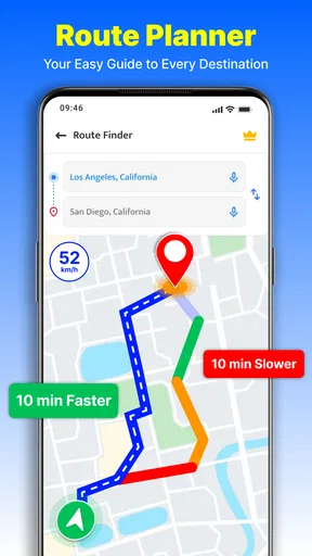
There is a practical trade-off in switching among map, street-level, weather and sharing tools: each can answer a different question, but moving between them may interrupt the simple “where do I turn now?” flow. My tip is to decide what you need before opening a view. If the goal is recognizing a building, use the street view; if it is understanding the surrounding layout, zoom out to the map; if it is reaching the address, focus on navigation. That keeps exploration useful instead of turning the trip into a sequence of taps.
What the journey feels like in practice
What I love most about Live Earth Map-Gps Satellite is that it allows you to explore the world without leaving the comfort of your home. Whether you're planning future travels or just want to satisfy your wanderlust, this app offers a fantastic way to see the world. The images are updated regularly, ensuring you’re always looking at the latest views.
Plus, if you’re a geography geek like me, you’ll appreciate the detailed information about each location. Want to know the population of a city or the height of a mountain? The app provides tidbits of information that make you feel like a knowledgeable traveler.
For a realistic everyday use, imagine I am visiting a relative in a neighborhood I have not seen before. I can look over the area at home, get a rough sense of the route and landmarks, and use a street-level view to recognize the final block. On the day, I can check the weather before deciding whether to walk from a nearby stop, then share my location with the person waiting for me. The useful outcome is not that every uncertainty disappears; it is that I arrive with a better mental picture and a clearer way to coordinate.
That workflow suits curious travellers, people who like to preview destinations, and anyone who finds aerial views helpful for making sense of a place. It is less compelling for users who want nothing beyond fast directions, or who need navigation to remain dependable in situations where a missed turn has serious consequences. In those cases, I would choose a well-established navigation tool as the primary option and use this app only for visual exploration, if its controls and results feel comfortable on my device.
Where the flow can break
The main caution is to keep expectations realistic. A satellite image can look impressively detailed without answering every practical question about access, current traffic, or the best entrance. Likewise, a weather glance is useful for planning but should not be the only basis for a long outdoor outing. I would check the route and destination before setting off, and avoid making the app the sole source of information when timing, safety or accessibility is important.
The rating gives me another reason to test it before depending on it. An average of 3.0 across 53 ratings is a modest reception, not a guarantee of a bad experience, but it does suggest I should judge the app on my own device rather than assume it will be flawless. The free starting price lowers the barrier to trying it, while the optional purchases mean I would check what is included before paying for anything. If all I need is basic directions, there is little reason to buy extras before I know they solve a problem I actually have.
I would also separate curiosity from navigation when planning a busy day. Browsing distant places can be absorbing, but it does not help if I am already late and need a clear next turn. My practical routine would be to explore and prepare in advance, keep the route question simple while moving, and use location sharing only when it makes coordination easier. That is a better fit for this app’s blend of discovery and travel tools than expecting every feature to behave like a dedicated driving assistant.
My recommendation
In a nutshell, Live Earth Map-Gps Satellite is a must-have for anyone with a curious mind and a love for exploration. It’s like having the world at your fingertips, quite literally. Whether you’re using it for practical purposes, like navigation and planning, or just for fun, this app doesn’t disappoint.
So, if you’re ready to embark on a virtual journey around the globe, give this app a whirl. Trust me, you won’t regret it. Just a heads up though – once you start exploring, it’s hard to stop!
My honest view is a little more selective: it is worth trying if you want satellite-based browsing and travel-oriented tools together, and you enjoy getting a visual feel for places before you visit. I would not install it expecting it to replace every map app on my phone. Start with a familiar destination, see how the map and route flow work for you, and decide whether the extra exploration features make the experience more useful than your usual navigator.
Pros
- High-resolution satellite imagery.
- Real-time weather updates.
- User-friendly interface.
- Variety of map views available.
- Offline map access.
Cons
- Requires a stable internet connection.
- Ads can be intrusive at times.
- Limited features in free version.
- May consume significant battery life.
- GPS accuracy can vary.
FAQs for Live Earth Map-Gps Satellite
What features does Live Earth Map-GPS Satellite offer?
Live Earth Map-GPS Satellite provides real-time satellite imagery, street views, and 3D maps. Users can explore various locations worldwide, check traffic conditions, and view geographical data. It also allows for GPS navigation and includes features such as location sharing and route planning to enhance the user experience.
Is Live Earth Map-GPS Satellite free to use?
The app is available for free with basic features. However, it offers in-app purchases and a premium subscription for advanced functionalities, such as ad-free browsing, enhanced map details, and offline map downloads. Users can decide if they need the additional features based on their requirements.
How accurate is the GPS navigation in Live Earth Map-GPS Satellite?
The GPS navigation in Live Earth Map-GPS Satellite is highly accurate, utilizing advanced satellite data to provide precise directions and real-time traffic updates. However, accuracy may vary based on your device's GPS capabilities and the availability of internet connectivity in certain areas.
Can I use Live Earth Map-GPS Satellite offline?
Yes, the app offers an offline mode, but this feature is typically available through a premium subscription. Users can download specific maps and access them without an internet connection, which is particularly useful for traveling in areas with limited network availability.
Is Live Earth Map-GPS Satellite available on both Android and iOS?
Yes, Live Earth Map-GPS Satellite is available for download on both Android and iOS platforms. Users can find it on the Google Play Store and Apple App Store, ensuring compatibility with a wide range of smartphones and tablets. Regular updates are provided to improve functionality and user experience.


